CityGML is an open data format developed to collect and store spatial information in the city in an XML-based format, including geometric, topological and semantic data.
It is an XML-based language defined by the Open Geospatial Consortium (OGC) to explain geographical features. GML has the ability to integrate not only vector data, but all geographic data.
GML models contain many basic elements;
Property
Geometry
Coordinate reference system
Topology
Time
Dynamic feature
Coverage (including geographic images)
Measurement unit
Instructions
Observations
Map presentation style rules
There are also many open source GML implementation schemes;
CityGML
AIXM
INSPIRE
GeoSciML
Nowadays, 3D city models are becoming increasingly popular. In 3D virtual cities, urban furniture, trees-plants, traffic lights-signs, people-animals and vehicles are displayed as 3D models. In this way, all spatial data about the city can be collected.
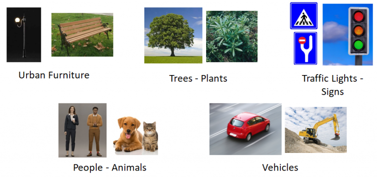
In order to collect and store spatial information in the city in an XML-based format, an open data format called CityGML has been developed. With CityGML, data including geometric, topological and semantic information of objects can be visualized, as well as querying and analyzing data. Thanks to semantic information, not only location information of objects but also attribute or thematic information can be obtained.
Together with CityGML;
3D Urban Models
Smart City Applications
City and Land Planning
3D Cadastre Applications
Urban Architecture Design Studies
Real estate valuation
Urban Landscape Studies
Tourist Practices and Urban Activities
Environmental Simulation Applications
Disaster Management and Planning
Pedestrian and Vehicle Navigation
Training Simulations
can be done.
GML (Geography Markup Language) is an XML-based language defined by the Open Geospatial Consortium (OGC) to describe geographical features; it can integrate not only vector data but all geographic data.
It is an open data format developed to collect and store spatial information about a city in an XML-based format, managing geometric, topological and semantic information of objects together.
They contain elements such as property, geometry, coordinate reference system, topology, time, dynamic feature, coverage, measurement unit, instructions, observations and map presentation style rules.
CityGML, AIXM, INSPIRE and GeoSciML are the main open source GML application schemas.