HD maps allow data acquisition accuracy of a few centimeters. Using detailed information such as lane models, HD maps enable automated and autonomous vehicles to be location-aware, environment-aware and path-aware.
According to the Society of Automotive Engineers (SAE), there are six different levels of driving autonomy that make a complete driving experience:
• Level 0 – No automation (including at most some audible warnings)
• Level 1 – Driver assistance
• Level 2 – Partial automation
• Level 3 – Conditional driving automation
• Level 4 – High driving automation
• Level 5 – Full driving automation
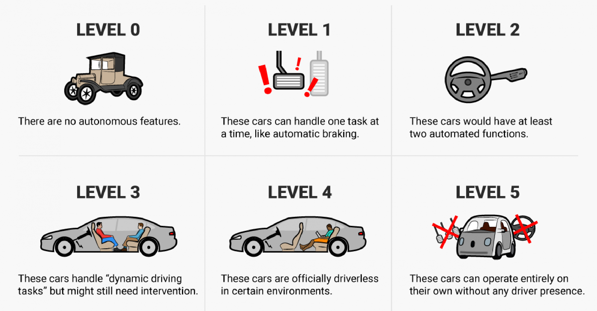
Level 1 or Level 2 automation use the ADAS (advanced driver assistance systems) map for driver assistance and safety warnings, such as lane departure warnings, and drivers have a safer and more comfortable journey. ADAS map provides with an accuracy of several meters.
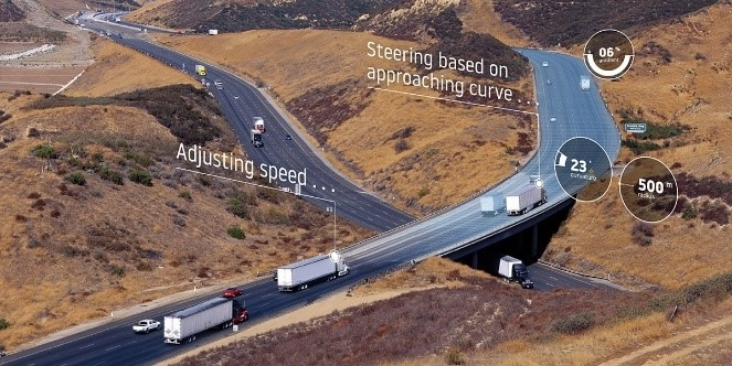
• Indicates the steepness of the ascent or descent of the road.
• Describes the positional accuracy – the sharpness – and direction of curves in the road.
• Covers more than 20 types of traffic signs and their meaning, including sub-plates.
• Indicates what is the maximum allowed speed for a road for a specific type of vehicle.
• Describes the positional accuracy and direction of curves per lane at intersections.
• Describes lane-level information such as direction and connectivity at intersections.
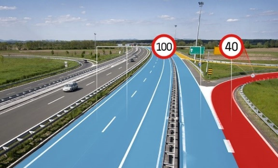
• HD maps allow data acquisition accuracy of a few centimeters.
• Using detailed information such as lane models, localization objects, lane-level speed restrictions, linear objects, traffic signs, road furniture and geometry per lane, HD maps enable automated and autonomous vehicles to become location-aware, environment-aware and path-aware.
• For the HD map, a few meters turn into a few centimeters. The HD map describes almost everything on the road with centimeter-level accuracy.
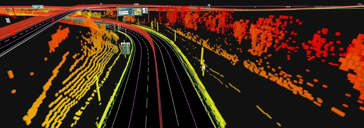
Aiding sensor perception for autonomous driving
HD map determines the movement of the vehicle by providing context to the observations made by the sensors. It helps to overcome difficulties by providing a reliable and robust model of the vehicle’s environment with data from sensors.
Highly accurate vehicle localization for autonomous driving
Today’s navigation systems mainly use GPS for localization; however, GPS alone fails to provide the necessary level of accuracy and reliability. HD Map has a number of layers that provide accurate and precise localization for autonomous vehicles supporting various sensor architectures.
Path planning for autonomous driving
An automated vehicle needs to be able to plan its path at a very granular level in order to plot maneuvers across lanes in a safe and comfortable way. Relying on vehicle sensors alone means having to perform path planning with a short horizon, limited to the sensors range. This can lead to inefficient or unsafe path planning. With the path planning enabled by HD maps, the vehicle can predict maneuvers safely and on time.
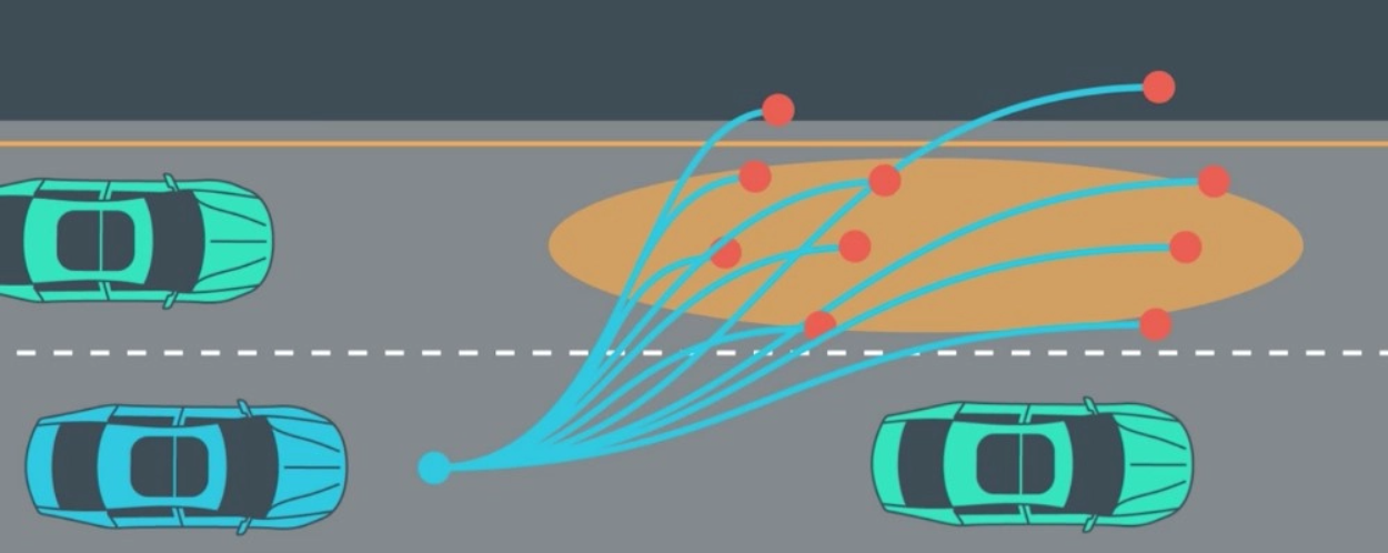
• The next generation of autonomous driving technology requires higher quality and more detailed map content to support sensor data and guarantee driver safety and comfort.
• Today, many new vehicles include a range of advanced driver assistance systems (ADAS), such as predictive powertrain control (PPC) and intelligent speed assistance (ISA).
• HD Map enables localization beyond GPS accuracy, helps with sensor perception and smoother path planning, all to increase driver safety and comfort.
• For higher levels of autonomous driving, cars rely on HD maps and the third version of ADASIS (ADAS interface specification) to handle the vast amounts of map data with lane-level accuracy. While the second ADASIS version only describes a road as a single line with attributes, the third version’s protocol can depict lane-level geometries of the road surface.
It is high-definition map technology providing lane-level positional accuracy and rich road content for autonomous driving systems.
According to the Society of Automotive Engineers (SAE), there are six levels of driving autonomy, from Level 0 (no automation) to Level 5 (full driving automation).
It is the map used by Level 1 and Level 2 automation for driver assistance and safety functions such as lane departure warnings, providing accuracy of several meters.
It covers the steepness of road ascents and descents, the positional accuracy, sharpness and direction of curves, more than 20 types of traffic signs including sub-plates, maximum allowed speeds per vehicle type, and lane-level positions at intersections.