Mobile maps provide many services such as 360-degree viewing of cities, measurement on panoramic images, real-time data generation and updates, knowing and updating the locations of city objects.
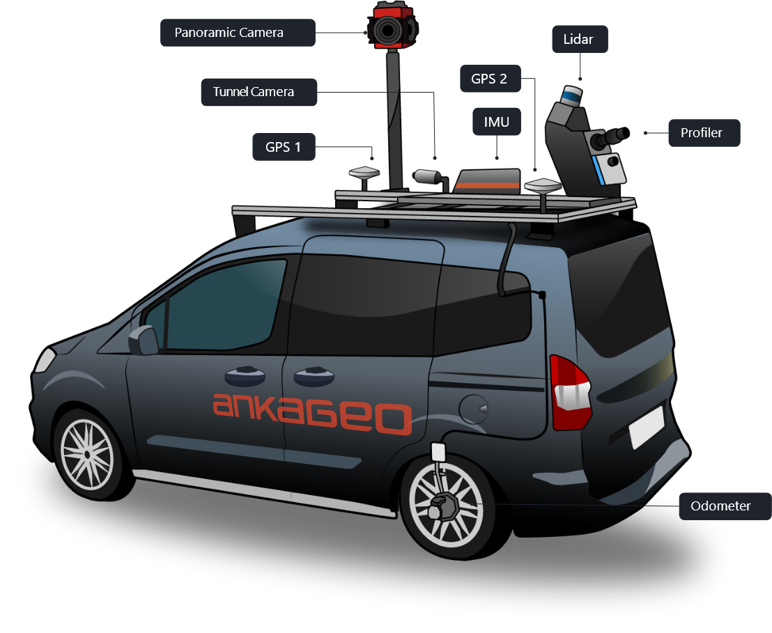
Mobile maps, which provide many services such as 360-degree viewing of cities, measurement on panoramic images, real-time data generation and updates, showing important centers that may be needed, knowing and updating the locations of city objects, it is generated from location data from mobile vehicles such as cars, drones, boats, trains or planes. Sensors such as GNSS, camera, LIDAR, radar, IMU are installed in mobile vehicles to produce and collect data.
With Mobile Mapping software, the data received from sensors integrated into mobile vehicles must be transferred to the developed software and visualized in order to reach the end user. Thanks to these software, mobile maps are created by processing, querying and analyzing data.
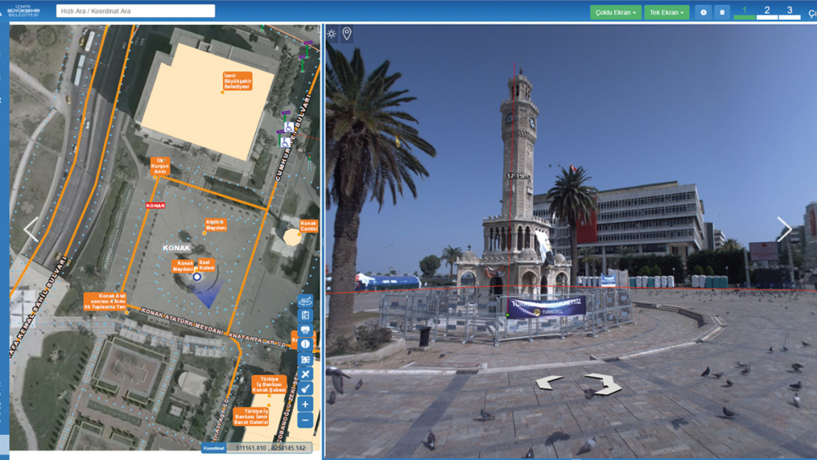
There are many options for the user in mobile maps. The user can easily reach the location he is looking for with the help of the interface designed in the software. In the mobile maps produced by ANKAGEO, besides the map, the user can also show the street views of the location he / she is looking for in 360 degrees. At the same time, route alternatives (bus, metro, metrobus, etc.) are presented to the user on this map.
Izmir-Scale Panoramic Shooting
Collection of 22,000 km of road and road data with mobile mapping system
Processing of data into the Geographic Information System Database
Preparing mobile and web software to update these data
Associating with the existing city guides owned by IMM and making it available on the internet and intranet
Istanbul Panoramic Shooting
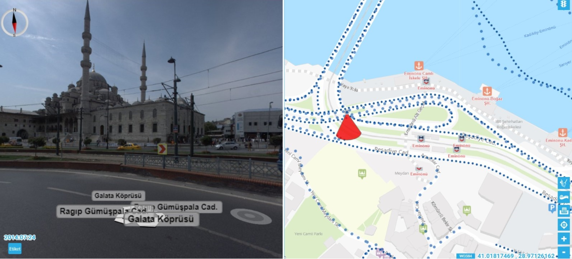
Panoramic image shooting of Istanbul’s 34,000 km avenues and streets
Of the period (2014) is shooting a panoramic image of the largest diameter made in Turkey
Integration to web, mobile and desktop applications
TURKSAT Tsunami Project
Panoramic image capture of 30,000 km in 22 provinces
To ensure effective use of TÜRKSAT Cable Systems Infrastructure
Managing assets, creating a base for marketing and projects, reaching customers faster
Possibility to obtain information about important places in the city (hotel, restaurant, public transportation stops, pharmacy, historical places, etc.)
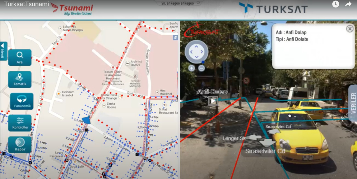
Image Based Information Management System
Europe’s largest mobile mapping project in Turkey is 95,000 km long road panoramic view of the area, road profiles and mm precision in the lidar was produced.
Completely domestic and national software
Mobile mapping vehicle design, calibration and integration
Data collection, processing and geo-coordinating from the field
Inventory production
Web and mobile server software
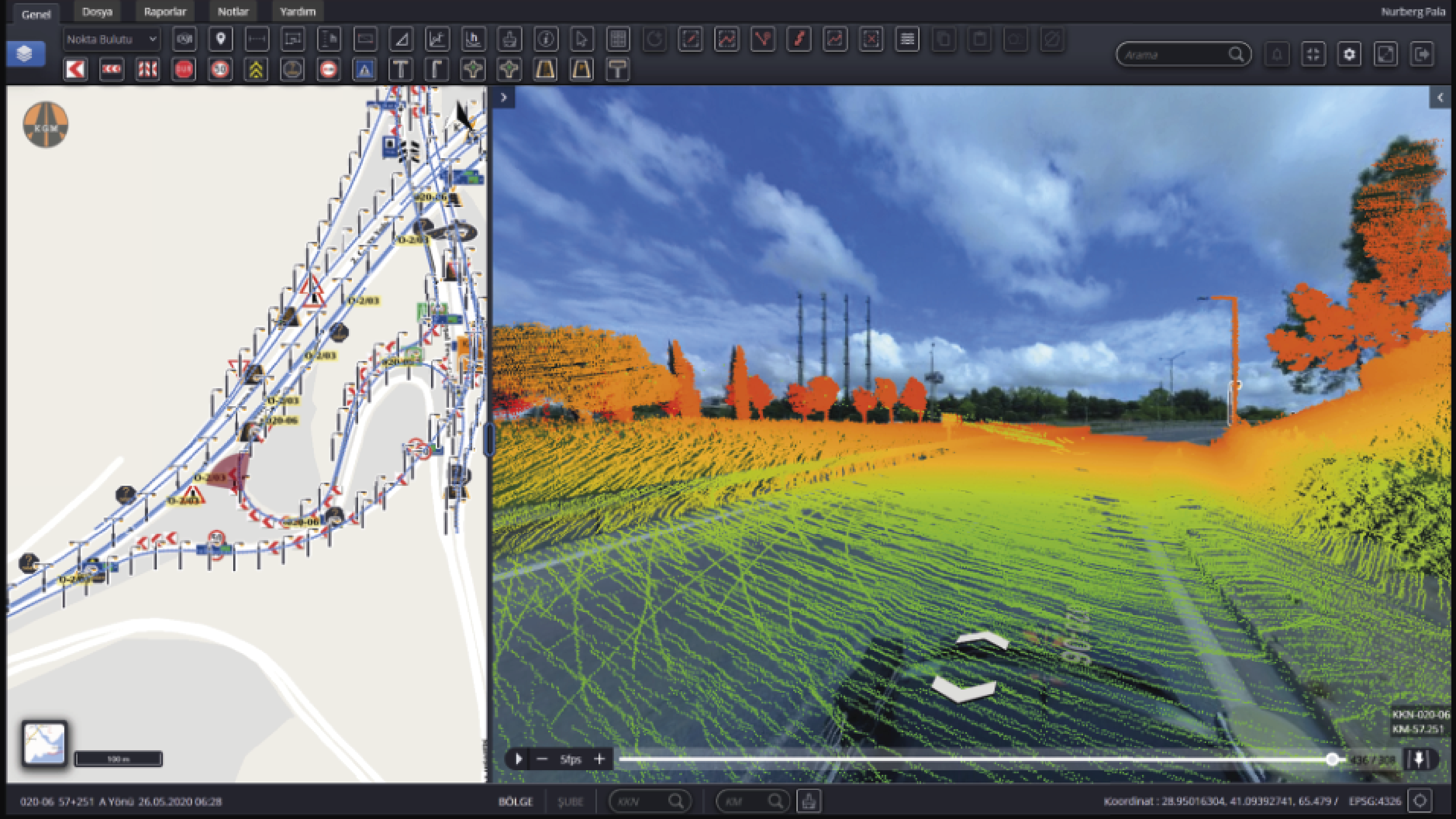
Mobile mapping software processes, queries and analyzes the data received from sensors integrated into mobile vehicles, visualizing it as mobile maps for the end user.
They are produced from location data collected by GNSS, camera, LiDAR, radar and IMU sensors installed on mobile vehicles such as cars, drones, boats, trains or planes.
Easy access to searched locations through the interface, 360° panoramic street views, and route alternatives such as bus, metro and metrobus.
In the Izmir-scale panoramic survey project, 22,000 km of road data was collected, processed into a GIS database and linked with existing city guides, published on the internet and intranet.